Road Classification in Transportation Engineering
GIS, Highway Design, Traffic Engineering, Trainings, Transportation Planning

Road Classification in Transportation Planning

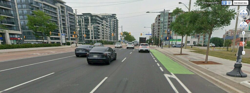
Road classification (or class) is a fundamental concept in transportation planning and traffic engineering. It provides a framework for organizing roads according to their function within the transportation network, specifically how they balance mobility (moving traffic efficiently) and access (serving adjacent land uses). Higher-class roads prioritize mobility, moving large volumes of traffic over longer distances […]

, , , , , , ,
Lost time Adjustment Synchro
Traffic Engineering, Trainings, Transportation Planning

Lost Time and Lost Time Adjustments in Synchro

In signalized intersection analysis, few parameters influence results as strongly and as quietly as lost time adjustment. When using Synchro or applying the Highway Capacity Manual (HCM) methodology, adjusting lost time can significantly change: Because of this sensitivity, lost time adjustments must be applied carefully, transparently, and defensibly. What is Lost Time? Lost time in

, , , ,
Saturation Flow Rate vs Lane Utilization Factor
Traffic Engineering, Trainings, Transportation Planning

Lane Utilization Factor and Saturation Flow Rate in Signalized Intersections

When performing signalized intersection analysis in tools such as Synchro or HCS, two commonly misunderstood parameters are Lane Utilization Factor (LUF) and Saturation Flow Rate (s). Both directly influence delay, capacity, and level of service calculations under the framework of the Highway Capacity Manual (HCM). This article provides a clear technical explanation of both terms

, , , ,
Pedestrian Counts
Public Transit, Traffic Engineering, Transportation & Climate Resilience, Transportation Planning

Using Pedestrian Counts in Traffic Engineering

Pedestrian counts are an essential input for intersection analysis (the main element in Traffic Impact Studies), particularly when modeling signalized intersections in software such as Synchro, Sidra, or VISUM. Unlike vehicle counts, pedestrians interact differently with traffic flows, and their impact on vehicle movements is captured through conflicting pedestrian volumes rather than directional “pedestrian flows.”

, , , ,
how to do traffic counting
Traffic Engineering, Trainings, Transportation Planning

How to Conduct Accurate Traffic Counts for Traffic Impact Studies

Traffic counts are the foundation of any Traffic Impact Assessment (TIS/TIA) and even Transportation Master Plans. Accurate traffic data ensures that intersection analyses, turning movements, and operational recommendations are reliable and defensible. This guide provides professional best practices for conducting traffic counts, including count duration, vehicle classification, intervals, intersection coordination, and the use of AI

, , , ,
Swept Path Analysis for Driveway design
Highway Design, Parking, Pavement, Traffic Engineering, Trainings, Transportation Planning

Swept Path Analysis and Vehicle Tracking in Traffic Impact Studies

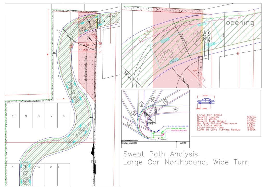
Swept path analysis (also referred to as vehicle tracking) is a core technical component of traffic engineering and site access review. It evaluates whether design vehicles can safely and realistically maneuver through intersections, site accesses, parking areas, and constrained roadway environments. For transportation planners, civil engineers, and approving agencies, swept path analysis provides defensible evidence

, , , , ,
Best Pdf Tool
Highway Design, Parking, Traffic Engineering, Trainings

Bluebeam vs Adobe vs Other PDF Tools: What Engineers and Transportation Planners Should Actually Use

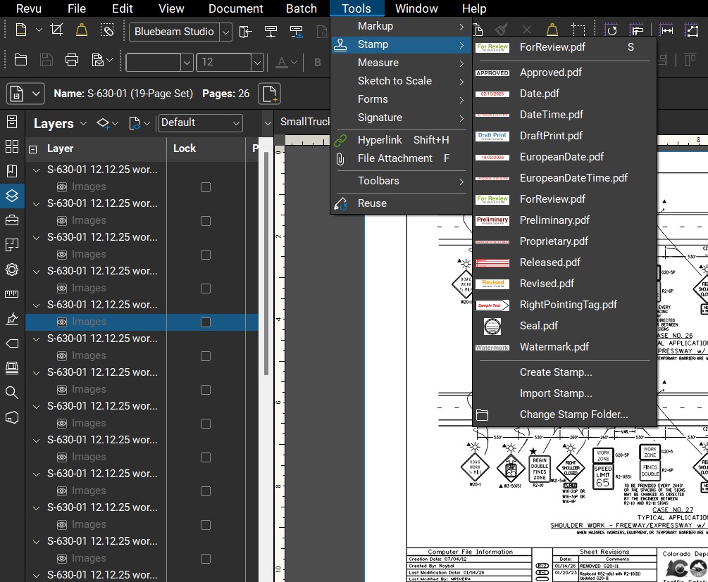
In engineering, planning, and infrastructure consulting, PDFs are a primary working format. Traffic impact studies, drawings, markups, review comments, and agency redlines are all typically exchanged, reviewed, and approved in PDF form. Yet many firms still rely on generic tools like Adobe Acrobat for highly technical review work. This article compares Bluebeam Revu, Adobe Acrobat,

, , ,
Reference standard road and highway geometries: lane widths, sidewalks, medians, shoulders, tapers, crosswalks, and signal heights in m & ft.
Highway Design, Pavement, Traffic Engineering, Trainings

Standard Geometries in Road and Highway Design: Quick Reference

Designing streets and highways requires careful attention to geometric standards. Lane widths, sidewalk sizes, medians, and other roadway elements affect safety, efficiency, and comfort. This guide provides a comprehensive reference for planners and traffic engineers, including typical dimensions for freeways, arterials, collectors, and local streets. All dimensions are shown in meters and feet, based on

, , ,
Highway Design, Public Transit, Trainings, Transportation Planning

Complete Streets: Designing Roads for Everyone

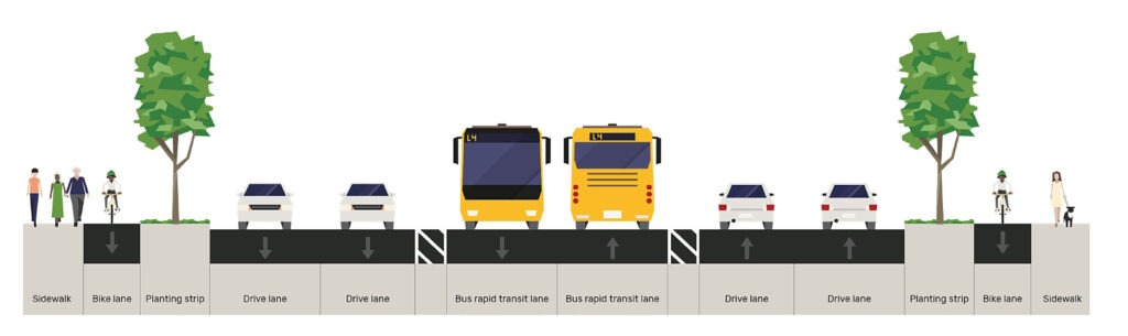
In modern urban planning, streets are no longer just about moving cars efficiently. A Complete Street is designed to safely accommodate all users; drivers, pedestrians, cyclists, transit riders, and people with disabilities. By prioritizing accessibility, safety, and connectivity, complete streets make communities more livable, sustainable, and vibrant. At Arterials, we help cities and developers understand

, , ,
What is ADT LOS DHV PHF in Transportation Engineering
Highway Design, Traffic Engineering, Trainings, Transportation Planning

Transportation & Traffic Engineering Abbreviations: Quick Reference Glossary

This glossary provides a comprehensive reference of commonly used abbreviations in transportation and traffic engineering. It covers terminology relevant to traffic studies, transportation planning, pavement design, and transit operations. Each entry includes a concise definition, with links to detailed guides or tools on Arterials.co, offering a reliable resource for professionals, planners, and students alike. Transportation

, , , , , ,
Scroll to Top