

Traffic Impact Studies, Parking Analysis & Mobility Planning – for Real-World Approvals
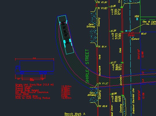
We support land developers, civil engineering firms, and public agencies with defensible transportation analysis, including Traffic Impact Assessment reports, trip generation, parking demand, swept path, and GIS-based planning.
Transportation Planning Services


Projects
0
Total Projects
0
Countries
0
Project Types
Why Arterials?
- 15+ Years of Transportation Engineering Consulting
- Projects Across Canada, USA, Middle East & South Asia
- Traffic Impact Studies, Transportation Master Plans & Peer Reviews
- Expertise in Synchro, VISUM, VISSIM & GIS Analysis
Planning a development? Need a Traffic Impact Study? Tell us about your project.